

SPC storm ingredients: feeds current
SPC storm ingredients: Feed current; checked .
Checked means retrieved, not newly issued. Each graphic retains its issue, observation, initialization or valid time. Site publishing status is separate.
Storm ingredients: SPC’s hourly analysis
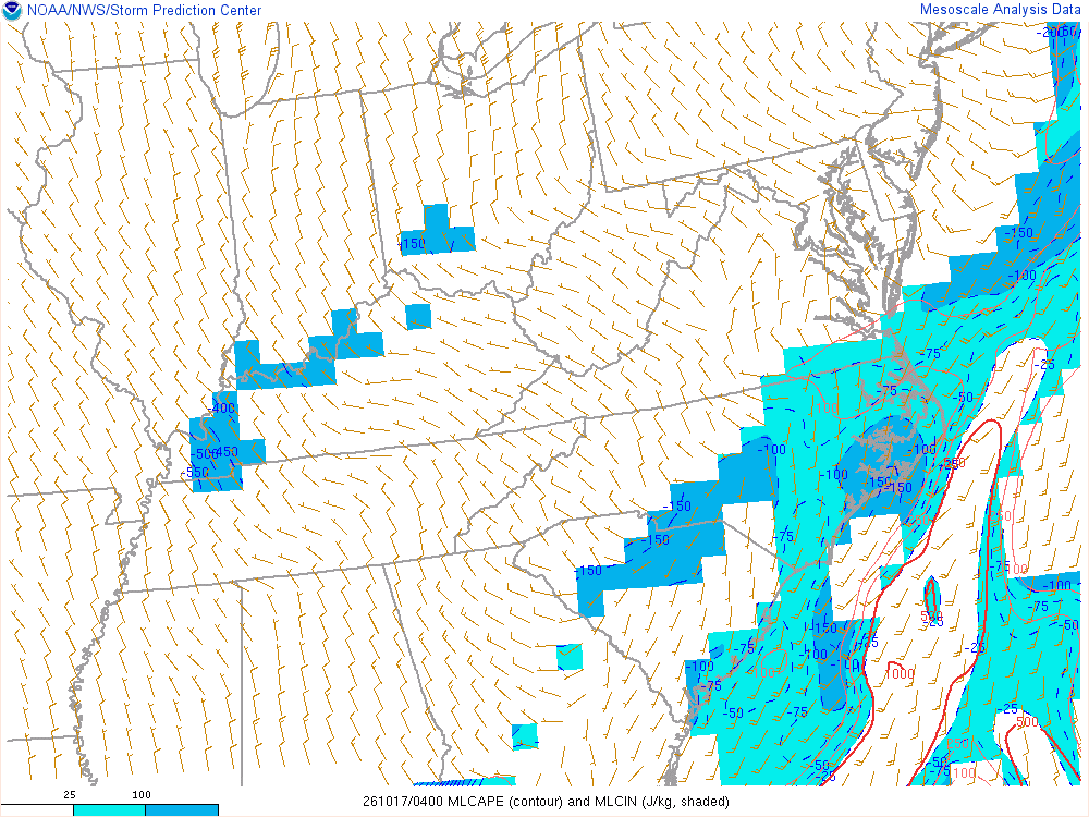
Instability: Mixed-layer CAPE and CIN (J/kg)
How much energy a rising parcel of air near the ground would have. More means stronger updrafts if storms form; the shaded cap (CIN) is what has to be overcome first, and storms may not form at all.
The technical reading
MLCAPE: convective available potential energy of a parcel with the mean properties of the lowest 100 mb, contoured in J/kg. MLCIN, shaded, is the convective inhibition below the level of free convection. Values over about 1,000 J/kg are moderate and over 2,500 large; under strong CIN a high CAPE can stay unused.
An ingredient, not a forecast: SPC’s analysis of the hour, from observations and a short-range model’s first guess. No one value is a warning or an outcome; storms need several ingredients together, and something to start them.
SPC mesoanalysis checked · Data: NOAA/SPC
Not an official warning service. Warnings and watches are the National Weather Service’s, outlooks and reports the Storm Prediction Center’s and the Weather Prediction Center’s (Data: NOAA/NWS, NOAA/SPC, NOAA/WPC). When a warning is issued for you, act on it, and use weather.gov or a NOAA Weather Radio for where you are.