

SPC storm ingredients: feeds current
SPC storm ingredients: Feed current; checked .
Checked means retrieved, not newly issued. Each graphic retains its issue, observation, initialization or valid time. Site publishing status is separate.
Storm ingredients: SPC’s hourly analysis
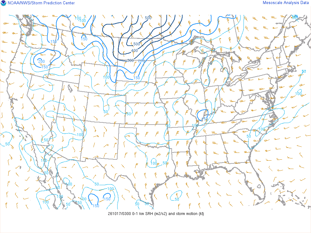
Low-level spin: 0–1 km storm-relative helicity (m²/s²)
How much spin the lowest kilometre of wind could give a storm’s updraft. Higher values matter for tornadoes only where supercells actually form.
The technical reading
Storm-relative helicity from the surface to 1 km above ground, using SPC’s estimated right-moving supercell motion, in m²/s². Values above roughly 100–150 favour tornadic supercells when other ingredients are present.
An ingredient, not a forecast: SPC’s analysis of the hour, from observations and a short-range model’s first guess. No one value is a warning or an outcome; storms need several ingredients together, and something to start them.
SPC mesoanalysis checked · Data: NOAA/SPC
Northern Mariana Islands briefing
Not an official warning service. Warnings and watches are the National Weather Service’s, outlooks and reports the Storm Prediction Center’s and the Weather Prediction Center’s (Data: NOAA/NWS, NOAA/SPC, NOAA/WPC). When a warning is issued for you, act on it, and use weather.gov or a NOAA Weather Radio for where you are.