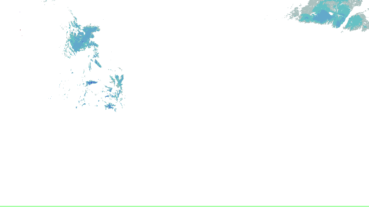
Source-rendered snow depth and snow water equivalent for the lower 48. History changes this snow picture only; warnings and radar keep their own clocks.
No NOHRSC picture displayed on the interactive map.
0 - 0.39 in
0.39 - 2.0 in
2.0 - 3.9 in
3.9 - 9.8 in
9.8 - 20 in
20 - 39 in
39 - 59 in
59 - 98 in
98 - 197 in
197 - 295 in
295 - 394 in
394 - 787 in
NOAA/NWS/NOHRSC’s original picture and legend. No station or address value is inferred.
NOHRSC footprint times are metadata; pixel analysis time is not independently verified. Snow-depth pixels have previously differed from the footprint time. This is modeled/assimilated snow analysis, not a measurement at a place. Unshaded and no-data areas do not establish zero snow.
Collector checked not reported; feed generated not reported. Zero cells does not establish coverage or clear weather. Observations from different radars are not merged.
Canon City Vicinity/Eastern Fremont County; Northern El Paso County/Monument Ridge/Rampart Range Below 7500 Ft; Colorado Springs Vicinity/Southern El Paso County/Rampart Range Below 7400 Ft; Pueblo Vicinity/Pueblo County Below 6300 Feet; Walsenburg Vicinity/Upper Huerfano River Basin Below 7500 Ft; Trinidad Vicinity/Western Las Animas County Below 7500 Ft; Crowley County; La Junta Vicinity/Otero County; Eastern Las Animas County; Western Kiowa County; Eastern Kiowa County; Las Animas Vicinity/Bent County; Lamar Vicinity/Prowers County; Springfield Vicinity/Baca County
Freeze Warning
Issued
Updated
Ends as issued
Office
NWS Pueblo CO
Take steps now to protect tender plants from the cold.
The polygon is a warned area, not a tornado footprint. NWS detection tags are independent of radar algorithms and reports.
Relevant watched places
Save named places to check their point against every supported warning.
Full official message
Freeze Warning issued October 16 at 5:11PM MDT until October 17 at 9:00AM MDT by NWS Pueblo CO
* WHAT...Sub-freezing temperatures as low as 28 expected.

* WHERE...All of southeast Colorado.

* WHEN...From midnight tonight to 9 AM MDT Saturday.

* IMPACTS...Frost and freeze conditions could kill crops, other
sensitive vegetation and possibly damage unprotected outdoor
plumbing.
Take steps now to protect tender plants from the cold.
Warning-message history (0)
No retained revisions are available in this recording window.
Data: NOAA/NWS · KPUB.FZ.W.0007
Recent source changes
radar-alerts · source-revision · Recorded 2026-10-17T04:33:03.173Z
office-afd · source-revision · Recorded 2026-10-17T04:30:06.468Z
hrrr · source-revision · Recorded 2026-10-17T04:30:06.285Z
metars · source-revision · Recorded 2026-10-17T04:30:06.285Z
surface-analysis · source-revision · Recorded 2026-10-17T04:30:06.285Z
radar-alerts · source-revision · Recorded 2026-10-17T04:27:03.184Z
office-hwo · source-revision · Recorded 2026-10-17T04:25:04.828Z
office-afd · source-revision · Recorded 2026-10-17T04:25:04.828Z
Recording coverage and limits
warnings: retained from 2026-10-16T04:34:23.381Z through 2026-10-17T04:34:03.254Z
outlooks: retained from 2026-10-16T04:34:23.381Z through 2026-10-17T04:30:06.468Z
hydro: retained from 2026-10-16T04:34:23.381Z through 2026-10-17T04:25:04.608Z
analysis: retained from 2026-10-16T04:34:23.381Z through 2026-10-17T04:30:06.285Z
winter: retained from 2026-10-16T04:34:23.381Z through 2026-10-17T04:23:03.245Z
Source-message history is not recorded imagery replay. Recorded radar/satellite imagery is not available in this view.
Auto-updating checks this site’s cache every minute; each source keeps its own clock.
Spotlight: Winter Storm Severity Index
1 of 15
Winter Storm Severity Index
WPC: “WSSI does not depict official warnings and should always be used in context with official NWS forecasts and warnings.”
WPC’s WSSI, overall impact, Days 1–3, valid to , issued . WPC issues each day and cause on its own clock. Not a warning, and not a chance. Data: NOAA/NWS/WPC.
Chance of Moderate impacts or worse, Day 1
WPC: “WSSI does not depict official warnings and should always be used in context with official NWS forecasts and warnings.”
WPC’s Probabilistic Winter Precipitation Forecast, to , issued . Outlines, as WPC draws them. Data: NOAA/NWS/WPC.
Winter watches, warnings and advisories
Freeze Warning55 not yet in effect · until · NWS Albuquerque NM, NWS Amarillo TX, NWS Dodge City KS, 2 more offices
Frost Advisory33 not yet in effect · until · NWS Norman OK, NWS Tulsa OK, NWS Wichita KS
NWS’s winter and cold alerts in force in the area, by event as issued, each counted once, with the offices that issued them and the latest end. Data: NOAA/NWS.
Snow on the ground
NOHRSC snow depth and snow water equivalent use the source’s original pictures and legends, with qualified footprint times. Open the cached source page for availability and retained history. This wall has no snow picture to rotate; missing imagery does not mean no snow.
Drawn by the Analysis tab’s own renderer. Data: NOAA/SPC, NOAA/NCEP.
The tropics
NHC’s and JTWC’s storms, their official graphics and the watches and warnings for them. Storm Mode’s own tropical panels arrive with its tropical events.
The Radar page’s winter preset over the area: HRDPS forecast snow with NWS’s warnings on top, loaded by your browser. A forecast, labelled as one there.
Not an official warning service. Warnings and watches are the National Weather Service’s, outlooks and reports the Storm Prediction Center’s and the Weather Prediction Center’s (Data: NOAA/NWS, NOAA/SPC, NOAA/WPC). When a warning is issued for you, act on it, and use weather.gov or a NOAA Weather Radio for where you are.


 0 - 0.39 in
 0.39 - 2.0 in
 2.0 - 3.9 in
 3.9 - 9.8 in
 9.8 - 20 in
 20 - 39 in
 39 - 59 in
 59 - 98 in
 98 - 197 in
 197 - 295 in
 295 - 394 in
 394 - 787 in