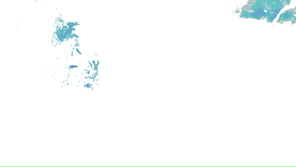
Source-rendered snow depth and snow water equivalent for the lower 48. History changes this snow picture only; warnings and radar keep their own clocks.
No NOHRSC picture displayed on the interactive map.
0 - 0.39 in
0.39 - 2.0 in
2.0 - 3.9 in
3.9 - 9.8 in
9.8 - 20 in
20 - 39 in
39 - 59 in
59 - 98 in
98 - 197 in
197 - 295 in
295 - 394 in
394 - 787 in
NOAA/NWS/NOHRSC’s original picture and legend. No station or address value is inferred.
NOHRSC footprint times are metadata; pixel analysis time is not independently verified. Snow-depth pixels have previously differed from the footprint time. This is modeled/assimilated snow analysis, not a measurement at a place. Unshaded and no-data areas do not establish zero snow.
Collector checked not reported; feed generated not reported. Zero cells does not establish coverage or clear weather. Observations from different radars are not merged.
Motorists should not attempt to drive around barricades or drive cars
through flooded areas.
Even 6 inches of fast-moving flood water can knock you off your feet
and a depth of 2 feet will float your car. Never try to walk, swim,
or drive through such swift water. If you come upon flood waters,
stop, turn around and go another way.
Additional information is available at www.weather.gov.
The next statement will be issued this evening at 915 PM CDT.
The polygon is a warned area, not a tornado footprint. NWS detection tags are independent of radar algorithms and reports.
Relevant watched places
Save named places to check their point against every supported warning.
Full official message
Flood Warning issued October 16 at 8:13PM CDT until October 19 at 1:00AM CDT by NWS Austin/San Antonio TX
...The Flood Warning is extended for the following rivers in Texas...

Rio Grande At Foster Ranch affecting Val Verde County.

...The Flood Warning is cancelled for the following rivers in
Texas...

Pecos River Near Langtry affecting Val Verde County.

* WHAT...Moderate flooding is forecast.

* WHERE...Rio Grande at Foster Ranch.

* WHEN...Until late Sunday night.

* IMPACTS...At 5.0 feet, Lowland flooding makes low water crossings
at Pandale on the Pecos River and tributaries flooded and
impassable. At 7.0 feet, (2.1 meters), Minor lowland flooding is a
significant threat to swimmers, tubers and campers on the low banks
of the Pecos River above Pandale to above Langtry. At 10.0 feet,
(3.0 meters), Moderate flooding is well into the flood plain making
secondary roads and crossings along the Pecos River and tributaries
very dangerous to travel. Swimmers and tubers should leave the
river as flow is dangerously turbulent. Campers vehicles and gear
in the flood plain can be swept downstream.


* ADDITIONAL DETAILS...
- At 7:15 PM CDT Friday the stage was 8.0 feet.
- Bankfull stage is 14.0 feet.
- Forecast...The river will rise above flood stage late tonight to
16.8 feet early tomorrow afternoon. It will then fall below flood
stage late tomorrow evening to 13.3 feet early Sunday morning. It
will rise to flood stage Sunday morning. It will then fall again
Sunday night.
- Flood stage is 14.0 feet.
- http://www.weather.gov/safety/flood
Motorists should not attempt to drive around barricades or drive cars
through flooded areas.

Even 6 inches of fast-moving flood water can knock you off your feet
and a depth of 2 feet will float your car. Never try to walk, swim,
or drive through such swift water. If you come upon flood waters,
stop, turn around and go another way.

Additional information is available at www.weather.gov.

The next statement will be issued this evening at 915 PM CDT.
WPC’s WSSI, overall impact, Days 1–3, valid to , issued . WPC issues each day and cause on its own clock. Not a warning, and not a chance. Data: NOAA/NWS/WPC.
Chance of Moderate impacts or worse, Day 1
WPC: “WSSI does not depict official warnings and should always be used in context with official NWS forecasts and warnings.”
WPC’s Probabilistic Winter Precipitation Forecast, to , issued . Outlines, as WPC draws them. Data: NOAA/NWS/WPC.
Winter watches, warnings and advisories
Freeze Warning55 not yet in effect · until · NWS Albuquerque NM, NWS Amarillo TX, NWS Lubbock TX, 2 more offices
Frost Advisory22 not yet in effect · until · NWS Amarillo TX, NWS Norman OK
NWS’s winter and cold alerts in force in the area, by event as issued, each counted once, with the offices that issued them and the latest end. Data: NOAA/NWS.
Snow on the ground
NOHRSC snow depth and snow water equivalent use the source’s original pictures and legends, with qualified footprint times. Open the cached source page for availability and retained history. This wall has no snow picture to rotate; missing imagery does not mean no snow.
Issued , for to . WPC’s words, as written. Data: NOAA/NWS/WPC.
Radar, winter preset
The Radar page’s winter preset over the area: HRDPS forecast snow with NWS’s warnings on top, loaded by your browser. A forecast, labelled as one there.
Not an official warning service. Warnings and watches are the National Weather Service’s, outlooks and reports the Storm Prediction Center’s and the Weather Prediction Center’s (Data: NOAA/NWS, NOAA/SPC, NOAA/WPC). When a warning is issued for you, act on it, and use weather.gov or a NOAA Weather Radio for where you are.


 0 - 0.39 in
 0.39 - 2.0 in
 2.0 - 3.9 in
 3.9 - 9.8 in
 9.8 - 20 in
 20 - 39 in
 39 - 59 in
 59 - 98 in
 98 - 197 in
 197 - 295 in
 295 - 394 in
 394 - 787 in