Storm Mode / Tracked area

Winter: Florida

Wall mode

2 warnings total · 0 tornado warnings · 2 alerts including watches and advisories

Current alert feed · checked

Warnings in area

2 of 2 alerts
  1. Flood WarningSarasota County, FLNWS Tampa Bay Ruskin FL · until warning · alerts checked
  2. Flood WarningLake and Volusia counties, FLNWS Melbourne FL · until warning · alerts checked

Watched places

Places saved on this device appear here with scripting enabled.

Find or save a place
Layers

Map

NWS’s polygons as issued, or the zones a zone-issued alert names; SPC’s watches by their counties. Checked . Data: NOAA/NWS, NOAA/SPC.

Agency warning geometry · no observed imagery displayed
North ↑

Interactive imagery loads separately. Missing radar does not remove warnings or imply clear weather.

Alert outlines: NOAA/NWS; cell points/observed segments: IEM/NEXRAD. A warning polygon is not a tornado footprint.

Lightning activity — GOES GLM

Total lightning, including in-cloud activity. Not ground-strike locations or a safe-to-go-outside signal.

Cached lightning observations have not loaded. An empty map is not zero lightning.

Cached lightning source details and text readings

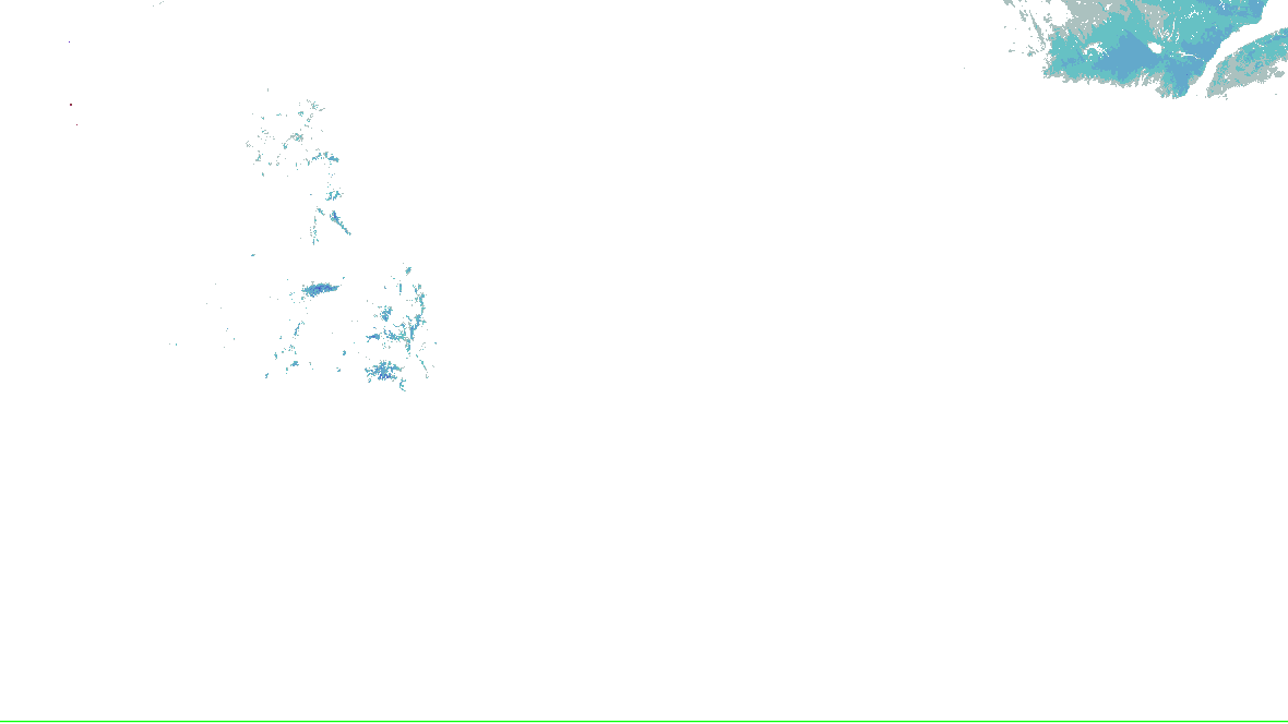
Snow analysis — NOHRSC

Source-rendered snow depth and snow water equivalent for the lower 48. History changes this snow picture only; warnings and radar keep their own clocks.

Stored snow depth · footprint valid 2026-10-18 00:00:00 UTC, picture retrieved 2026-10-18 06:23:06.237 UTC.

No NOHRSC picture displayed on the interactive map.

  • 0 - 0.39 in
  • 0.39 - 2.0 in
  • 2.0 - 3.9 in
  • 3.9 - 9.8 in
  • 9.8 - 20 in
  • 20 - 39 in
  • 39 - 59 in
  • 59 - 98 in
  • 98 - 197 in
  • 197 - 295 in
  • 295 - 394 in
  • 394 - 787 in
NOHRSC snow analysis for the lower 48; see the adjacent source legend and time qualification
NOAA/NWS/NOHRSC’s original picture and legend. No station or address value is inferred.

NOHRSC footprint times are metadata; pixel analysis time is not independently verified. Snow-depth pixels have previously differed from the footprint time. This is modeled/assimilated snow analysis, not a measurement at a place. Unshaded and no-data areas do not establish zero snow.

Snow pictures, retained history and source provenance

Change time or forecast product

Replay uses retained source bytes. Recording begins with activation; missing history is not clear weather.

Live sources keep independent clocks.

Replay coverage and interpretation

Rolling target: 24 hours; cells: six hours. Radar: NOAA MRMS national overview, 8-minute tolerance. Satellite: original GOES GeoColor day/night picture, hourly sampling, 75-minute tolerance. No interpolation or latest-image fallback. Warning and source checks retain their own clocks. “Recorded by” is collector acquisition evidence, not exact browser publication history.

Current GLM density, velocity and specialist layers are hidden during replay. Snow uses retained footprint metadata with unverified pixel time. Forecast uses one pinned issuance/run and exact valid time.

No observed replay frame displayed.

Open the complete replay reader (works without scripting or WebGL)
Radar-derived cells (6) · current

Collector checked ; feed generated . Zero cells does not establish coverage or clear weather. Observations from different radars are not merged.

  1. DJT / C7 · scan 2026-10-18T07:47:26Z · stale
  2. EVX / O0 · scan 2026-10-18T07:51:58Z · current
  3. EVX / P0 · scan 2026-10-18T07:51:58Z · current
  4. JAX / C0 · scan 2026-10-18T07:48:24Z · current
  5. MLB / U8 · scan 2026-10-18T07:49:35Z · current
  6. TBW / W5 · scan 2026-10-18T07:49:32Z · current
Station and river observations (79)

Surface source current; observed water-level source current. Each reading keeps its own time. Map markers show at most 500 stations and 500 gauges; the complete source directory is paginated.

Circle: surface station; square: water-level gauge. Filled: current reading and source; hollow: stale, unconfirmed or missing observation. Marker color is not a hazard category. Enable “Stations and gauges” in Layers to inspect them on the map.

Showing 79 of 79 listed sources. All surface stations and retained trends · All supported gauges and forecasts

Selected details

Close

Surface station KBCR

current · Observed 2026-10-18 06:58:00 UTC · wind 4 kt · temperature 11.7 °C.

Station KBCR · -85.6043, 30.8432 (longitude, latitude).

Source checked 2026-10-18 07:45:06.573Z · current.

Station observations, not an address forecast or cyclone maximum wind. Maintenance-flagged, old and implausible reports are excluded by the existing parser; this is not independent NWS quality control.

Retained observations: 24; target 24 hours, at most 96 reports per station. Recording began 2026-10-17 06:15:07.108Z; oldest available reading 2026-10-17 07:58:00 UTC.

Observed sustained wind at KBCR (kt)Dots are retained observations. Lines break for missing fields, long intervals or changed station location or units. 0 recorded discontinuities. Dashed lines, when present, are the separately issued NWS forecast.16.12.9kt10-17 07:58Z10-18 06:58Z2026-10-17 07:58:00 UTC · 12 kt2026-10-17 08:58:00 UTC · 11 kt2026-10-17 09:58:00 UTC · 8 kt2026-10-17 10:58:00 UTC · 11 kt2026-10-17 11:58:00 UTC · 9 kt2026-10-17 12:58:00 UTC · 8 kt2026-10-17 13:58:00 UTC · 15 kt2026-10-17 14:58:00 UTC · 14 kt2026-10-17 15:58:00 UTC · 7 kt2026-10-17 16:58:00 UTC · 13 kt2026-10-17 17:58:00 UTC · 10 kt2026-10-17 18:58:00 UTC · 9 kt2026-10-17 19:58:00 UTC · 12 kt2026-10-17 20:58:00 UTC · 9 kt2026-10-17 21:58:00 UTC · 12 kt2026-10-17 22:58:00 UTC · 5 kt2026-10-17 23:58:00 UTC · 5 kt2026-10-18 00:58:00 UTC · 6 kt2026-10-18 01:58:00 UTC · 5 kt2026-10-18 02:58:00 UTC · 6 kt2026-10-18 03:58:00 UTC · 5 kt2026-10-18 04:58:00 UTC · 5 kt2026-10-18 05:58:00 UTC · 4 kt2026-10-18 06:58:00 UTC · 4 kt
Observed sustained wind · 24 retained observations; 0 discontinuities. Lines join reported values only; missing intervals are not interpolated.
Temperature, dew point and pressure trends
Observed temperature at KBCR (°C)Dots are retained observations. Lines break for missing fields, long intervals or changed station location or units. 0 recorded discontinuities. Dashed lines, when present, are the separately issued NWS forecast.23.310.6°C10-17 07:58Z10-18 06:58Z2026-10-17 07:58:00 UTC · 17.2 °C2026-10-17 08:58:00 UTC · 16.1 °C2026-10-17 09:58:00 UTC · 15.6 °C2026-10-17 10:58:00 UTC · 14.4 °C2026-10-17 11:58:00 UTC · 13.3 °C2026-10-17 12:58:00 UTC · 13.3 °C2026-10-17 13:58:00 UTC · 14.4 °C2026-10-17 14:58:00 UTC · 16.1 °C2026-10-17 15:58:00 UTC · 18.9 °C2026-10-17 16:58:00 UTC · 20 °C2026-10-17 17:58:00 UTC · 21.1 °C2026-10-17 18:58:00 UTC · 22.2 °C2026-10-17 19:58:00 UTC · 21.7 °C2026-10-17 20:58:00 UTC · 21.7 °C2026-10-17 21:58:00 UTC · 21.1 °C2026-10-17 22:58:00 UTC · 19.4 °C2026-10-17 23:58:00 UTC · 17.8 °C2026-10-18 00:58:00 UTC · 16.1 °C2026-10-18 01:58:00 UTC · 15.6 °C2026-10-18 02:58:00 UTC · 15 °C2026-10-18 03:58:00 UTC · 14.4 °C2026-10-18 04:58:00 UTC · 13.3 °C2026-10-18 05:58:00 UTC · 12.8 °C2026-10-18 06:58:00 UTC · 11.7 °C
Observed temperature · 24 retained observations; 0 discontinuities. Lines join reported values only; missing intervals are not interpolated.
Observed dew point at KBCR (°C)Dots are retained observations. Lines break for missing fields, long intervals or changed station location or units. 0 recorded discontinuities. Dashed lines, when present, are the separately issued NWS forecast.112.9°C10-17 07:58Z10-18 06:58Z2026-10-17 07:58:00 UTC · 9.4 °C2026-10-17 08:58:00 UTC · 10 °C2026-10-17 09:58:00 UTC · 7.2 °C2026-10-17 10:58:00 UTC · 5 °C2026-10-17 11:58:00 UTC · 3.9 °C2026-10-17 12:58:00 UTC · 4.4 °C2026-10-17 13:58:00 UTC · 3.9 °C2026-10-17 14:58:00 UTC · 5 °C2026-10-17 15:58:00 UTC · 6.1 °C2026-10-17 16:58:00 UTC · 5.6 °C2026-10-17 17:58:00 UTC · 6.1 °C2026-10-17 18:58:00 UTC · 6.7 °C2026-10-17 19:58:00 UTC · 6.1 °C2026-10-17 20:58:00 UTC · 6.7 °C2026-10-17 21:58:00 UTC · 6.7 °C2026-10-17 22:58:00 UTC · 7.2 °C2026-10-17 23:58:00 UTC · 7.8 °C2026-10-18 00:58:00 UTC · 7.8 °C2026-10-18 01:58:00 UTC · 7.8 °C2026-10-18 02:58:00 UTC · 7.8 °C2026-10-18 03:58:00 UTC · 7.8 °C2026-10-18 04:58:00 UTC · 7.8 °C2026-10-18 05:58:00 UTC · 7.2 °C2026-10-18 06:58:00 UTC · 7.2 °C
Observed dew point · 24 retained observations; 0 discontinuities. Lines join reported values only; missing intervals are not interpolated.
Observed sea-level pressure at KBCR (mb)Dots are retained observations. Lines break for missing fields, long intervals or changed station location or units. 0 recorded discontinuities. Dashed lines, when present, are the separately issued NWS forecast.1024.81015.3mb10-17 07:58Z10-18 06:58Z2026-10-17 07:58:00 UTC · 1016.3 mb2026-10-17 08:58:00 UTC · 1016.5 mb2026-10-17 09:58:00 UTC · 1017.1 mb2026-10-17 10:58:00 UTC · 1017.7 mb2026-10-17 11:58:00 UTC · 1018.2 mb2026-10-17 12:58:00 UTC · 1018.9 mb2026-10-17 13:58:00 UTC · 1019.5 mb2026-10-17 14:58:00 UTC · 1019.5 mb2026-10-17 15:58:00 UTC · 1018.9 mb2026-10-17 16:58:00 UTC · 1018.2 mb2026-10-17 17:58:00 UTC · 1017.9 mb2026-10-17 18:58:00 UTC · 1017.4 mb2026-10-17 19:58:00 UTC · 1017.4 mb2026-10-17 20:58:00 UTC · 1017.2 mb2026-10-17 21:58:00 UTC · 1017.7 mb2026-10-17 22:58:00 UTC · 1018.5 mb2026-10-17 23:58:00 UTC · 1022 mb2026-10-18 00:58:00 UTC · 1022.7 mb2026-10-18 01:58:00 UTC · 1023.2 mb2026-10-18 02:58:00 UTC · 1023.8 mb2026-10-18 03:58:00 UTC · 1021.4 mb2026-10-18 04:58:00 UTC · 1021.5 mb2026-10-18 05:58:00 UTC · 1021.6 mb2026-10-18 06:58:00 UTC · 1021.9 mb
Observed sea-level pressure · 24 retained observations; 0 discontinuities. Lines join reported values only; missing intervals are not interpolated.
Observed reports as a table (24)
Observed (UTC)Wind / gust (kt)From (° true)Temperature / dew point (°C)Pressure (mb)Visibility (mi)
2026-10-17 07:58:00 UTC12 / 23 34017.2 / 9.41016.310 or more
2026-10-17 08:58:00 UTC11 / 18 33016.1 / 101016.510 or more
2026-10-17 09:58:00 UTC8 / 20 35015.6 / 7.21017.110 or more
2026-10-17 10:58:00 UTC11 / 22 34014.4 / 51017.710 or more
2026-10-17 11:58:00 UTC9 / 23 36013.3 / 3.91018.210 or more
2026-10-17 12:58:00 UTC8 / 15 35013.3 / 4.41018.910 or more
2026-10-17 13:58:00 UTC15 / 25 36014.4 / 3.91019.510 or more
2026-10-17 14:58:00 UTC14 / 23 1016.1 / 51019.510 or more
2026-10-17 15:58:00 UTC7 / 22 1018.9 / 6.11018.910 or more
2026-10-17 16:58:00 UTC13 / 25 2020 / 5.61018.210 or more
2026-10-17 17:58:00 UTC10 / 21 1021.1 / 6.11017.910 or more
2026-10-17 18:58:00 UTC9 / 22 35022.2 / 6.71017.410 or more
2026-10-17 19:58:00 UTC12 / 23 1021.7 / 6.11017.410 or more
2026-10-17 20:58:00 UTC9 / 20 2021.7 / 6.71017.210 or more
2026-10-17 21:58:00 UTC12 / 20 3021.1 / 6.71017.710 or more
2026-10-17 22:58:00 UTC5 / Not reported36019.4 / 7.21018.510 or more
2026-10-17 23:58:00 UTC5 / Not reported35017.8 / 7.8102210 or more
2026-10-18 00:58:00 UTC6 / Not reportedVariable16.1 / 7.81022.710 or more
2026-10-18 01:58:00 UTC5 / Not reported35015.6 / 7.81023.210 or more
2026-10-18 02:58:00 UTC6 / Not reported36015 / 7.81023.810 or more
2026-10-18 03:58:00 UTC5 / Not reported1014.4 / 7.81021.410 or more
2026-10-18 04:58:00 UTC5 / Not reported36013.3 / 7.81021.510 or more
2026-10-18 05:58:00 UTC4 / Not reported36012.8 / 7.21021.610 or more
2026-10-18 06:58:00 UTC4 / Not reported1011.7 / 7.21021.910 or more
Capture times, quality and provenance

Each report keeps its observation time, first capture of this version, and the SHA-256 of the source bulk body. Corrections at the same observation time replace that point and are marked; unrelated bulk-file changes do not freshen a report.

  • Observed 2026-10-17 07:58:00 UTC, captured 2026-10-17 08:15:10.499Z; source body SHA-256 a39722f704ee162691aaecdd40de5ce5fee94d2d7f6291ad35f498846325d650.
  • Observed 2026-10-17 08:58:00 UTC, captured 2026-10-17 09:15:07.673Z; source body SHA-256 016271d991e052b4ca0bb6a0412411402fcafc0acde04052dffa85b284d7e986.
  • Observed 2026-10-17 09:58:00 UTC, captured 2026-10-17 10:15:07.619Z; source body SHA-256 efa29a4c0d0a7e81934e340e5f363562848208a428e561ca8ffb8afe4fee1d5d.
  • Observed 2026-10-17 10:58:00 UTC, captured 2026-10-17 11:15:07.064Z; source body SHA-256 7b8de7613178a73bdf0132bc79f470b3cc468514bec5c0458f7c710d68cffae8.
  • Observed 2026-10-17 11:58:00 UTC, captured 2026-10-17 12:15:07.983Z; source body SHA-256 f0704332759fe1131fe9887da5385e3460868b43f6138106aac1bb8c7676254c.
  • Observed 2026-10-17 12:58:00 UTC, captured 2026-10-17 13:15:08.402Z; source body SHA-256 235074cffed89b4cab92d4ab7ccfd328bf69ddc8588653f76dece65dfad02f56.
  • Observed 2026-10-17 13:58:00 UTC, captured 2026-10-17 14:15:08.468Z; source body SHA-256 89c5e2da6c1df15fc284a3f38b9662d6ab7633272342363f5f2103f7f1dca9bc.
  • Observed 2026-10-17 14:58:00 UTC, captured 2026-10-17 15:15:08.165Z; source body SHA-256 03e82f238e3281188a3e527cc38fc1ce4ad8af25fe75f76604b458e9da0f511c.
  • Observed 2026-10-17 15:58:00 UTC, captured 2026-10-17 16:15:08.351Z; source body SHA-256 59505eba151176b08b86d3a0c0daddc8ef63138a51e6f0371050096e6264ba55.
  • Observed 2026-10-17 16:58:00 UTC, captured 2026-10-17 17:15:07.865Z; source body SHA-256 eef453fe75bb9f7371aeb86c73bf75725d6277e3652437a825018d7fc35df410.
  • Observed 2026-10-17 17:58:00 UTC, captured 2026-10-17 18:15:09.016Z; source body SHA-256 d40c721ef04f917fd2bc85c84ea40a5039d51af5cdf6376401aac6045358c892.
  • Observed 2026-10-17 18:58:00 UTC, captured 2026-10-17 19:15:08.055Z; source body SHA-256 9b1ec8d3a0f8f89c0d1ebd7a0bd7e7ce037e6cc9a183d6538ed27218bec705c5.
  • Observed 2026-10-17 19:58:00 UTC, captured 2026-10-17 20:15:10.245Z; source body SHA-256 5d4b4c11801ee60c6534338573ef2e859efd777f86df72fad00181ad9621832e.
  • Observed 2026-10-17 20:58:00 UTC, captured 2026-10-17 21:15:07.640Z; source body SHA-256 5c08daef9b0bed8ea3c5b6b7557a0f630a469dd035658cb1bb27d1dc72c4fd3d.
  • Observed 2026-10-17 21:58:00 UTC, captured 2026-10-17 22:15:08.810Z; source body SHA-256 08e0e95877116ded1805cae8d7e901c7e3d8d957682f02835e0dae15380c17e6.
  • Observed 2026-10-17 22:58:00 UTC, captured 2026-10-17 23:15:09.343Z; source body SHA-256 c50273d54023d9eed3fa370998416e92a710a0360dfdf59dd328dfb33e4357f3.
  • Observed 2026-10-17 23:58:00 UTC, captured 2026-10-18 00:15:08.772Z; source body SHA-256 2e4c6ad295ac837c980c59790d7a701d3f94b395e669ad24a6f5d6eeb1bc7aaa.
  • Observed 2026-10-18 00:58:00 UTC, captured 2026-10-18 01:15:11.480Z; source body SHA-256 4e03e4713df8355508ff6e003de099fa794d8905f60515988527c0359147ddbe.
  • Observed 2026-10-18 01:58:00 UTC, captured 2026-10-18 02:15:09.964Z; source body SHA-256 96d6803b8c6f76d1b7153a523f8f2c76dd3341c87fa0d79a41eada37a566a9a0.
  • Observed 2026-10-18 02:58:00 UTC, captured 2026-10-18 03:15:10.023Z; source body SHA-256 286048f59de6ba9e40cefa7baf3b30600d840a609330ffdd3c5421c3e015acde.
  • Observed 2026-10-18 03:58:00 UTC, captured 2026-10-18 04:15:10.808Z; source body SHA-256 3208f6bb3bd857b2dec6e5a4113a661211834775509581ca2d816ebbf9290282.
  • Observed 2026-10-18 04:58:00 UTC, captured 2026-10-18 05:15:08.294Z; source body SHA-256 57652e3f3058d24864856efeb99784611227e7184ee8800c86e3726c5b8f0231.
  • Observed 2026-10-18 05:58:00 UTC, captured 2026-10-18 06:15:09.754Z; source body SHA-256 d6f3e8bcbd73123bac653833e25613be22b44ed899976dd1627107027cbfeb90.
  • Observed 2026-10-18 06:58:00 UTC, captured 2026-10-18 07:15:08.677Z; source body SHA-256 faedea1b22dd965e600368b0420535bdc8168cf37050ce6169b899861ed12bb6.

Values use the decoded station report. Null means not reported, never zero. Gust is kept separate from sustained wind.

Observation source page · Cached readings as JSON · Official source

Recent source changes

Recording coverage and limits
  • warnings: retained from 2026-10-17T07:57:29.052Z through 2026-10-18T07:57:03.598Z
  • outlooks: retained from 2026-10-17T07:57:29.052Z through 2026-10-18T07:55:07.208Z
  • hydro: retained from 2026-10-17T07:57:29.052Z through 2026-10-18T07:55:07.943Z
  • analysis: retained from 2026-10-17T07:57:29.052Z through 2026-10-18T07:45:08.639Z
  • winter: retained from 2026-10-17T07:57:29.052Z through 2026-10-18T07:53:05.075Z

Source-message history is not recorded imagery replay. Recorded radar/satellite imagery is not available in this view.

Checks every minute; each layer keeps its own time.

Spotlight: Winter Storm Severity Index

1 of 7

Winter Storm Severity Index

WPC: “WSSI does not depict official warnings and should always be used in context with official NWS forecasts and warnings.”

  • Winter Weather Area
  • Minor Impacts
  • Moderate Impacts
  • Major Impacts
  • Extreme Impacts

Highest in this area, by day and by cause

Day 1
nothing drawn
Day 2
nothing drawn
Day 3
nothing drawn
Snow amount, Days 1–3
nothing drawn
Snow load, Days 1–3
nothing drawn
Ice, Days 1–3
nothing drawn
Blowing snow, Days 1–3
nothing drawn

Each day and cause on the Winter tab, with its own issue time

WPC’s WSSI, overall impact, Days 1–3, valid to , issued . WPC issues each day and cause on its own clock. Not a warning, and not a chance. Data: NOAA/NWS/WPC.

Chance of Moderate impacts or worse, Day 1

WPC: “WSSI does not depict official warnings and should always be used in context with official NWS forecasts and warnings.”

  • 5–10% (not drawn)
  • 10–20% (not drawn)
  • 20–30% (not drawn)
  • 30–40% (not drawn)
  • 40–50% (not drawn)
  • 50–60% (not drawn)
  • 60–70% (not drawn)
  • 70–80% (not drawn)
  • 80–90% (not drawn)
  • 90–95% (not drawn)
  • 95% or more (not drawn)

Each level and day on the Winter tab

WPC’s WSSI-P: no chance drawn for Day 1. Data: NOAA/NWS/WPC.

Chance of at least 4 inches of snow, Day 1

WPC gives no chance of 4 inches of snow or more in this area over the next three days, so Day 1’s 4 inches is shown.

  • Slight: at least 10%
  • Moderate: at least 40%
  • High: at least 70%

Every day and amount on the Winter tab

WPC’s Probabilistic Winter Precipitation Forecast, to , issued . Outlines, as WPC draws them. Data: NOAA/NWS/WPC.

Winter watches, warnings and advisories

No winter or cold watch, warning or advisory in force in this area.

NWS’s winter and cold alerts in force in the area, by event as issued, each counted once, with the offices that issued them and the latest end. Data: NOAA/NWS.

Snow on the ground

NOHRSC snow depth and snow water equivalent use the source’s original pictures and legends, with qualified footprint times. Open the cached source page for availability and retained history. This wall has no snow picture to rotate; missing imagery does not mean no snow.

NOHRSC snow analysis and retained pictures

Data: NOAA/NWS/NOHRSC. Snow analysis, not a measurement at a place.

WPC’s heavy snow and icing discussion

The whole discussion

Issued , for to . WPC’s words, as written. Data: NOAA/NWS/WPC.

Radar, winter preset

The Radar page’s winter preset over the area: HRDPS forecast snow with NWS’s warnings on top, loaded by your browser. A forecast, labelled as one there.

Open the radar

Live tiles; the radar keeps no last-good copy.

What changed, last 60 minutes

since , when this server began watching this area
  1. WPC snow and ice chances issued
  2. WPC snow and ice chances issued
  3. WPC snow and ice chances issued
  4. WPC snow and ice chances issued
  5. WPC snow and ice chances issued

The products’ own words and times, and what is no longer in force since the last read. Never written by AI.

Monitoring area, legacy alert summary and selection rules
Area
Florida (NWS states: FL)
Hazards
Winter warnings, watches and advisories, and the forecasts for them
Window
In force now, with the next days of SPC’s and WPC’s products
Made by
This address: anyone can make one, and nothing is stored. Change the area or hazards

An area you chose, not a storm’s footprint: everything here is in force in this area, never “from this storm”.

In force in this area

No warning, watch or advisory for these hazards is in force in this area.

NWS’s alerts checked : a successful check, so this is none in force, not “can’t tell”.

Sources

Not an official warning service. Warnings and watches are the National Weather Service’s, outlooks and reports the Storm Prediction Center’s and the Weather Prediction Center’s (Data: NOAA/NWS, NOAA/SPC, NOAA/WPC). When a warning is issued for you, act on it, and use weather.gov or a NOAA Weather Radio for where you are.