Storm Mode / Tracked area

Tropical: Oklahoma

Wall mode

10 warnings total · 0 tornado warnings · 14 alerts including watches and advisories

Current alert feed · checked

Warnings in area

14 of 14 alerts
  1. Flood WarningPayne County, OKNWS Norman OK · until warning · alerts checked
  2. Flood WarningJackson, Kiowa and Tillman counties, OKNWS Norman OK · until warning · alerts checked
  3. Flood WarningCleveland, McClain and Pottawatomie counties, OKNWS Norman OK · until warning · alerts checked
  4. Flood WarningCleveland and McClain counties, OKNWS Norman OK · until warning · alerts checked
  5. Flood WarningCanadian, Cleveland, Grady and McClain counties, OKNWS Norman OK · until warning · alerts checked
  6. Freeze WarningCimarron; Texas; Beaver; Dallam; Sherman; Hansford; Ochiltree; Lipscomb; Hartley; Moore; Hutchinson; Roberts; Hemphill; Oldham; Potter; Carson; Gray; Deaf Smith; Randall; Armstrong; Palo Duro CanyonNWS Amarillo TX · until warning · alerts checked
  7. Freeze WarningTrego; Ellis; Scott; Lane; Ness; Rush; Hamilton; Kearny; Finney; Hodgeman; Pawnee; Stafford; Stanton; Grant; Haskell; Gray; Ford; Edwards; Kiowa; Pratt; Morton; Stevens; Seward; Meade; Clark; Comanche; BarberNWS Dodge City KS · until warning · alerts checked
  8. Freeze WarningHarper; EllisNWS Norman OK · until warning · alerts checked
  9. Freeze WarningNorthwest Plateau; Espanola Valley; Santa Fe Metro Area; Middle Rio Grande Valley/Albuquerque Metro Area; Lower Rio Grande Valley; Central Highlands; South Central Highlands; Upper Tularosa Valley; Far Northeast Highlands; Union County; Harding County; Eastern San Miguel County; Guadalupe County; Quay County; Curry County; Roosevelt County; De Baca County; Chaves County Plains; Eastern Lincoln County; Southwest Chaves County; San Agustin Plains and Adjacent LowlandsNWS Albuquerque NM · until warning · alerts checked
  10. Freeze WarningCanon City Vicinity/Eastern Fremont County; Northern El Paso County/Monument Ridge/Rampart Range Below 7500 Ft; Colorado Springs Vicinity/Southern El Paso County/Rampart Range Below 7400 Ft; Pueblo Vicinity/Pueblo County Below 6300 Feet; Walsenburg Vicinity/Upper Huerfano River Basin Below 7500 Ft; Trinidad Vicinity/Western Las Animas County Below 7500 Ft; Crowley County; La Junta Vicinity/Otero County; Eastern Las Animas County; Western Kiowa County; Eastern Kiowa County; Las Animas Vicinity/Bent County; Lamar Vicinity/Prowers County; Springfield Vicinity/Baca CountyNWS Pueblo CO · until warning · alerts checked
  11. Flood WatchTillman; Cotton; Jefferson; Wichita; ClayNWS Norman OK · until watch · radar-alerts checked
  12. Frost AdvisoryWoods; Alfalfa; Grant; Kay; Woodward; Major; Garfield; Noble; Roger Mills; Dewey; Custer; Beckham; Washita; Harmon; GreerNWS Norman OK · until advisory · radar-alerts checked
  13. Frost AdvisoryMarion; Chase; Harvey; Butler; Greenwood; Woodson; Allen; Sedgwick; Harper; Sumner; Cowley; Elk; Wilson; ChautauquaNWS Wichita KS · until advisory · radar-alerts checked
  14. Frost AdvisoryWashington; Pawnee; Western Osage; Northeast Osage; Southeast OsageNWS Tulsa OK · until advisory · radar-alerts checked

Watched places

Places saved on this device appear here with scripting enabled.

Find or save a place
Layers

Map

NWS’s polygons as issued, or the zones a zone-issued alert names; SPC’s watches by their counties. Checked . Data: NOAA/NWS, NOAA/SPC.

Agency warning geometry · no observed imagery displayed
North ↑

Interactive imagery loads separately. Missing radar does not remove warnings or imply clear weather.

Alert outlines: NOAA/NWS; cell points/observed segments: IEM/NEXRAD. A warning polygon is not a tornado footprint.

Lightning activity — GOES GLM

Total lightning, including in-cloud activity. Not ground-strike locations or a safe-to-go-outside signal.

Cached lightning observations have not loaded. An empty map is not zero lightning.

Cached lightning source details and text readings

Snow analysis — NOHRSC

Source-rendered snow depth and snow water equivalent for the lower 48. History changes this snow picture only; warnings and radar keep their own clocks.

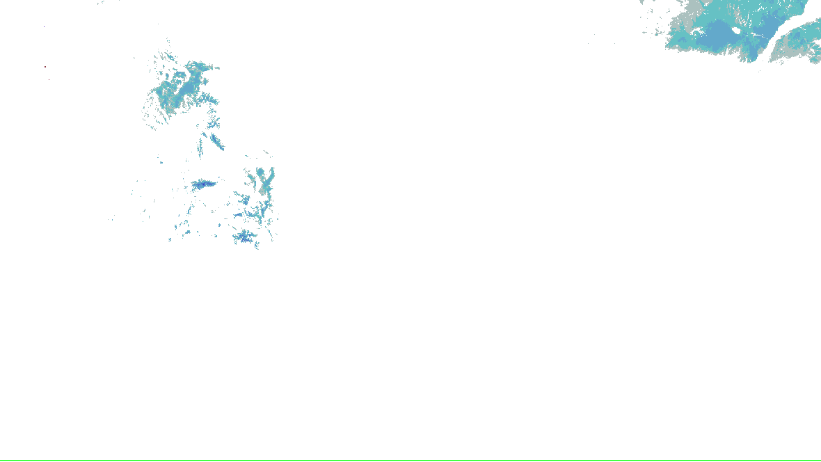
Stored snow depth · footprint valid 2026-10-17 00:00:00 UTC, picture retrieved 2026-10-17 06:08:57.387 UTC.

No NOHRSC picture displayed on the interactive map.

  • 0 - 0.39 in
  • 0.39 - 2.0 in
  • 2.0 - 3.9 in
  • 3.9 - 9.8 in
  • 9.8 - 20 in
  • 20 - 39 in
  • 39 - 59 in
  • 59 - 98 in
  • 98 - 197 in
  • 197 - 295 in
  • 295 - 394 in
  • 394 - 787 in
NOHRSC snow analysis for the lower 48; see the adjacent source legend and time qualification
NOAA/NWS/NOHRSC’s original picture and legend. No station or address value is inferred.

NOHRSC footprint times are metadata; pixel analysis time is not independently verified. Snow-depth pixels have previously differed from the footprint time. This is modeled/assimilated snow analysis, not a measurement at a place. Unshaded and no-data areas do not establish zero snow.

Snow pictures, retained history and source provenance

Radar-derived cells (0) · unavailable

Collector checked not reported; feed generated not reported. Zero cells does not establish coverage or clear weather. Observations from different radars are not merged.

    Station and river observations (56)

    Surface source current; observed water-level source current. Each reading keeps its own time. Map markers show at most 500 stations and 500 gauges; the complete source directory is paginated.

    Circle: surface station; square: water-level gauge. Filled: current reading and source; hollow: stale, unconfirmed or missing observation. Marker color is not a hazard category. Enable “Stations and gauges” in Layers to inspect them on the map.

    Showing 56 of 56 listed sources. All surface stations and retained trends · All supported gauges and forecasts

    Selected details

    Close

    Water-level gauge HEAO2

    current · Observed 16.22 ft at 2026-10-17 05:00:00 UTC · Moderate flooding.

    River gauge · Headrick · North Fork of the Red River · -99.103691, 34.638127000000004. Units ft; datum not supplied.

    Source checked 2026-10-17 06:55:04.416Z · current.

    Stage in this gauge’s units, not a regional flood depth. Tide/lake gauges remain water levels; datum is not supplied by this feed. Historical observations and the latest forecast keep separate times.

    Retained observations: 1; target 24 hours, at most 96 reports per station. Recording began 2026-10-17 06:15:05.234Z; oldest available reading 2026-10-17 05:00:00 UTC.

    Observed stage and separate NWS forecast at HEAO2 (ft)Dots are retained observations. Lines break for missing fields, long intervals or changed station location or units. 0 recorded discontinuities. Dashed lines, when present, are the separately issued NWS forecast.17.58.2ft10-17 05:00Z10-22 00:00Z2026-10-17 05:00:00 UTC · 16.22 ft
    Observed stage and separate NWS forecast · 1 retained observations; 0 discontinuities. Dashed: NWS forecast issued 2026-10-17 00:52:00 UTC; forecast valid times are not observations. Lines join reported values only; missing intervals are not interpolated.

    NWS forecast · current

    Highest listed forecast: 16.2 ft at 2026-10-17 12:00:00 UTC; issued 2026-10-17 00:52:00 UTC. Moderate flooding.

    Forecasts are issued as needed during times of high water, but are not routinely available.

    Gauge thresholds: action 12 ft; minor 14 ft; moderate 16 ft; major 19 ft.

    Forecast points (20) · issued 2026-10-17 00:52:00 UTC
    Forecast valid time (UTC)Forecast Stage
    2026-10-17 06:00:00 UTC16.5 ft
    2026-10-17 12:00:00 UTC16.2 ft
    2026-10-17 18:00:00 UTC15.8 ft
    2026-10-18 00:00:00 UTC15.3 ft
    2026-10-18 06:00:00 UTC14.8 ft
    2026-10-18 12:00:00 UTC14.2 ft
    2026-10-18 18:00:00 UTC13.6 ft
    2026-10-19 00:00:00 UTC13 ft
    2026-10-19 06:00:00 UTC12.2 ft
    2026-10-19 12:00:00 UTC11.5 ft
    2026-10-19 18:00:00 UTC11 ft
    2026-10-20 00:00:00 UTC10.6 ft
    2026-10-20 06:00:00 UTC10.3 ft
    2026-10-20 12:00:00 UTC10.1 ft
    2026-10-20 18:00:00 UTC9.9 ft
    2026-10-21 00:00:00 UTC9.7 ft
    2026-10-21 06:00:00 UTC9.6 ft
    2026-10-21 12:00:00 UTC9.4 ft
    2026-10-21 18:00:00 UTC9.3 ft
    2026-10-22 00:00:00 UTC9.2 ft
    NWS gauge impact statements
    • 22 ft: Significant...widespread flooding with dangerous currents and depths up to 8 feet occurs along the river in Kiowa... Jackson... and Tillman counties. Prolonged isolation of some agricultural lands and rural roads also occurs. Upstream points in Kiowa County may see flooding several hours before the crest reaches the Headrick area. The flood crest reaches downstream points near Tipton much later.
    • 21 ft: Significant...widespread flooding with dangerous currents and depths up to 7 feet occurs along the river in Kiowa... Jackson... and Tillman counties. Prolonged isolation of some agricultural lands and rural roads also occurs. Upstream points in Kiowa County may see flooding several hours before the crest reaches the Headrick area. The flood crest reaches downstream points near Tipton much later.
    • 20 ft: Significant...widespread flooding with dangerous currents and depths up to 6 feet occurs along the river in Kiowa... Jackson... and Tillman counties. Prolonged isolation of some agricultural lands and rural roads also occurs. Upstream points in Kiowa County may see flooding several hours before the crest reaches the Headrick area. The flood crest reaches downstream points near Tipton much later.
    • 19 ft: Flooding to depths of 5 feet or isolation of agricultural lands and rural roads occurs in Kiowa... Jackson... and Tillman counties. Upstream points in Kiowa County may see flooding several hours before the crest reaches the Headrick area. The flood crest reaches downstream points near Tipton much later. Flood depths approach 5 feet over some areas along the river.
    • 18 ft: Flooding or isolation of agricultural lands and rural roads occurs in Kiowa... Jackson... and Tillman counties. Upstream points in Kiowa County may see flooding several hours before the crest reaches the Headrick area. The flood crest reaches downstream points near Tipton much later. Flood depths approach 4 feet over some areas along the river.
    • 17 ft: Flooding or isolation of agricultural lands and rural roads occurs in Kiowa... Jackson... and Tillman counties. Upstream points in Kiowa County may see flooding several hours before the crest reaches the Headrick area. The flood crest reaches downstream points near Tipton much later. Flood depths approach 3 feet over some areas along the river.
    • 16 ft: Flooding or isolation of agricultural lands and rural roads occurs in Kiowa... Jackson... and Tillman counties. Upstream points in Kiowa County may see flooding several hours before the crest reaches the Headrick area. The flood crest reaches downstream points near Tipton much later. Flood depths approach 2 feet over some areas along the river.
    • 15 ft: Flooding or isolation of agricultural lands and rural roads occurs in Kiowa... Jackson... and Tillman counties. Upstream points in Kiowa County may see flooding several hours before the crest reaches the Headrick area. The flood crest reaches downstream points near Tipton much later. Flood depths approach 1 foot over some areas along the river.
    • 14 ft: Shallow flooding or isolation of agricultural lands and rural roads occurs in Kiowa... Jackson... and Tillman counties. Upstream points in Kiowa County may see flooding several hours before the crest reaches the Headrick area. The flood crest reaches downstream points near Tipton much later.
    • 13 ft: Near bankfull stages or higher occur along the river occur in Kiowa... Jackson... and Tillman counties. Upstream points in Kiowa County may see high stages several hours before the crest reaches the Headrick area. The crest reaches downstream points near Tipton much later.
    • 12 ft: The river remains within its banks in Kiowa... Jackson... and Tillman counties.
    Observed reports as a table (1)
    Observed (UTC)Stage / unitsSource category / water
    2026-10-17 05:00:00 UTC16.22 ftModerate flooding · River gauge
    Capture times, quality and provenance

    Each report keeps its observation time, first capture of this version, and the SHA-256 of the source bulk body. Corrections at the same observation time replace that point and are marked; unrelated bulk-file changes do not freshen a report.

    • Observed 2026-10-17 05:00:00 UTC, captured 2026-10-17 06:15:05.234Z; source body SHA-256 59def4ab364727656cb6987939ba27a3a22ae792b74344565dc73a5086b5ca2b.

    Only observed gauge records enter this history. Forecast maxima and forecast hydrograph points never become observations. A missing datum or unsupported flow value remains unknown.

    Observation source page · Cached readings as JSON · Official source

    Recent source changes

    Recording coverage and limits
    • warnings: retained from 2026-10-16T06:56:18.664Z through 2026-10-17T06:56:03.363Z
    • outlooks: retained from 2026-10-16T06:56:18.664Z through 2026-10-17T06:55:05.711Z
    • hydro: retained from 2026-10-16T06:56:18.664Z through 2026-10-17T06:55:05.903Z
    • analysis: retained from 2026-10-16T06:56:18.664Z through 2026-10-17T06:45:06.740Z
    • winter: retained from 2026-10-16T06:56:18.664Z through 2026-10-17T06:53:04.057Z

    Source-message history is not recorded imagery replay. Recorded radar/satellite imagery is not available in this view.

    Auto-updating checks this site’s cache every minute; each source keeps its own clock.

    Spotlight: The tropics

    1 of 2

    The tropics

    NHC’s and JTWC’s storms, their official graphics and the watches and warnings for them. Storm Mode’s own tropical panels arrive with its tropical events.

    Open the Tropics page

    Data: NOAA/NHC, JTWC.

    Radar

    NOAA’s radar for the area, loaded by your browser as on the Radar page.

    Open the radar

    Live tiles; the radar keeps no last-good copy.

    What changed, last 60 minutes

    since , when this server began watching this area

    Nothing has changed since 06:56Z.

    The products’ own words and times, and what is no longer in force since the last read. Never written by AI.

    Monitoring area, legacy alert summary and selection rules
    Area
    Oklahoma (NWS states: OK)
    Hazards
    Tropical warnings, watches and advisories, and the forecasts for them
    Window
    In force now, with the next days of SPC’s and WPC’s products
    Made by
    This address: anyone can make one, and nothing is stored. Change the area or hazards

    An area you chose, not a storm’s footprint: everything here is in force in this area, never “from this storm”.

    In force in this area

    No warning, watch or advisory for these hazards is in force in this area.

    NWS’s alerts checked : a successful check, so this is none in force, not “can’t tell”.

    Sources

    Not an official warning service. Warnings and watches are the National Weather Service’s, outlooks and reports the Storm Prediction Center’s and the Weather Prediction Center’s (Data: NOAA/NWS, NOAA/SPC, NOAA/WPC). When a warning is issued for you, act on it, and use weather.gov or a NOAA Weather Radio for where you are.