Storm Mode / Tracked area

Coastal flooding: Pennsylvania

Wall mode

7 warnings total · 0 tornado warnings · 8 alerts including watches and advisories

Current alert feed · checked

Warnings in area

8 of 8 alerts
  1. Freeze WarningWashington; Frederick; Carroll; Northern Baltimore; Extreme Western Allegany; Central and Eastern Allegany; Northwest Harford; Western Garrett; Eastern Garrett; Augusta; Rockingham; Shenandoah; Frederick; Page; Warren; Clarke; Western Highland; Eastern Highland; Western Loudoun; Northern Virginia Blue Ridge; Central Virginia Blue Ridge; Hampshire; Morgan; Berkeley; Jefferson; Hardy; Western Grant; Eastern Grant; Western Mineral; Eastern Mineral; Western Pendleton; Eastern PendletonNWS Baltimore MD/Washington DC · until warning · alerts checked
  2. Freeze WarningLackawanna; LuzerneNWS Binghamton NY · until warning · alerts checked
  3. Freeze WarningLucas; Wood; Ottawa; Sandusky; Erie; Lorain; Cuyahoga; Geauga; Ashtabula Inland; Hancock; Seneca; Huron; Medina; Summit; Portage; Trumbull; Wyandot; Crawford; Richland; Ashland; Wayne; Stark; Mahoning; Marion; Morrow; Holmes; Knox; Southern Erie; CrawfordNWS Cleveland OH · until warning · alerts checked
  4. Freeze WarningWarren; Potter; Elk; Cameron; Northern Clinton; Clearfield; Northern Centre; Southern Centre; Cambria; Blair; Huntingdon; Mifflin; Juniata; Somerset; Bedford; Fulton; Franklin; Tioga; Northern Lycoming; Sullivan; Southern Clinton; Southern Lycoming; Union; Snyder; Montour; Northumberland; Columbia; Perry; Dauphin; Schuylkill; Lebanon; Cumberland; Adams; York; LancasterNWS State College PA · until warning · alerts checked
  5. Freeze WarningNorthern Fairfield; Northern New Haven; Northern Middlesex; Northern New London; Western Passaic; Orange; PutnamNWS Upton NY · until warning · alerts checked
  6. Freeze WarningTuscarawas; Carroll; Columbiana; Coshocton; Harrison; Jefferson; Muskingum; Guernsey; Belmont; Noble; Monroe; Mercer; Venango; Forest; Lawrence; Butler; Clarion; Jefferson; Beaver; Allegheny; Armstrong; Washington; Greene; Westmoreland; Westmoreland Ridges; Fayette; Fayette Ridges; Indiana; Higher Elevations of Indiana; Hancock; Brooke; Ohio; Marshall; Wetzel; Marion; Monongalia; Ridges of Eastern Monongalia and Northwestern Preston; Preston; Eastern Preston; Western Tucker; Eastern TuckerNWS Pittsburgh PA · until warning · alerts checked
  7. Freeze WarningSussex; Carbon; Monroe; Warren; Morris; Hunterdon; Berks; Lehigh; Northampton; Western Chester; Western Montgomery; Upper BucksNWS Mount Holly NJ · until warning · alerts checked
  8. Frost AdvisoryLake; Ashtabula Lakeshore; Northern ErieNWS Cleveland OH · until advisory · radar-alerts checked

Watched places

Places saved on this device appear here with scripting enabled.

Find or save a place
Layers

Map

NWS’s polygons as issued, or the zones a zone-issued alert names; SPC’s watches by their counties. Checked . Data: NOAA/NWS, NOAA/SPC.

Agency warning geometry · no observed imagery displayed
North ↑

Interactive imagery loads separately. Missing radar does not remove warnings or imply clear weather.

Alert outlines: NOAA/NWS; cell points/observed segments: IEM/NEXRAD. A warning polygon is not a tornado footprint.

Lightning activity — GOES GLM

Total lightning, including in-cloud activity. Not ground-strike locations or a safe-to-go-outside signal.

Cached lightning observations have not loaded. An empty map is not zero lightning.

Cached lightning source details and text readings

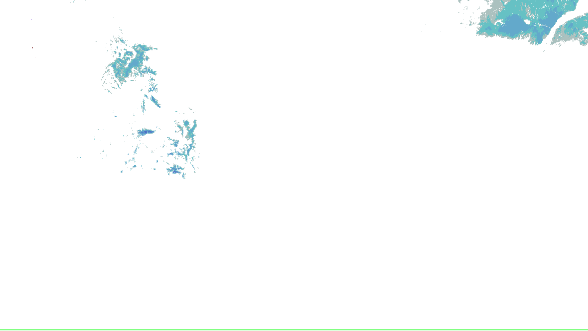
Snow analysis — NOHRSC

Source-rendered snow depth and snow water equivalent for the lower 48. History changes this snow picture only; warnings and radar keep their own clocks.

Stored snow depth · footprint valid 2026-10-17 00:00:00 UTC, picture retrieved 2026-10-17 06:08:57.387 UTC.

No NOHRSC picture displayed on the interactive map.

  • 0 - 0.39 in
  • 0.39 - 2.0 in
  • 2.0 - 3.9 in
  • 3.9 - 9.8 in
  • 9.8 - 20 in
  • 20 - 39 in
  • 39 - 59 in
  • 59 - 98 in
  • 98 - 197 in
  • 197 - 295 in
  • 295 - 394 in
  • 394 - 787 in
NOHRSC snow analysis for the lower 48; see the adjacent source legend and time qualification
NOAA/NWS/NOHRSC’s original picture and legend. No station or address value is inferred.

NOHRSC footprint times are metadata; pixel analysis time is not independently verified. Snow-depth pixels have previously differed from the footprint time. This is modeled/assimilated snow analysis, not a measurement at a place. Unshaded and no-data areas do not establish zero snow.

Snow pictures, retained history and source provenance

Radar-derived cells (0) · unavailable

Collector checked not reported; feed generated not reported. Zero cells does not establish coverage or clear weather. Observations from different radars are not merged.

    Station and river observations (41)

    Surface source current; observed water-level source current. Each reading keeps its own time. Map markers show at most 500 stations and 500 gauges; the complete source directory is paginated.

    Circle: surface station; square: water-level gauge. Filled: current reading and source; hollow: stale, unconfirmed or missing observation. Marker color is not a hazard category. Enable “Stations and gauges” in Layers to inspect them on the map.

    Showing 41 of 41 listed sources. All surface stations and retained trends · All supported gauges and forecasts

    Selected details

    Close

    Current NWS warning

    Lucas; Wood; Ottawa; Sandusky; Erie; Lorain; Cuyahoga; Geauga; Ashtabula Inland; Hancock; Seneca; Huron; Medina; Summit; Portage; Trumbull; Wyandot; Crawford; Richland; Ashland; Wayne; Stark; Mahoning; Marion; Morrow; Holmes; Knox; Southern Erie; Crawford

    Freeze Warning

    Issued
    Updated
    Ends as issued
    Office
    NWS Cleveland OH
    Take steps now to protect tender plants from the cold.

    Official NWS warning ↗

    The polygon is a warned area, not a tornado footprint. NWS detection tags are independent of radar algorithms and reports.

    Relevant watched places

    Save named places to check their point against every supported warning.
    Full official message

    Freeze Warning issued October 17 at 12:39AM EDT until October 18 at 9:00AM EDT by NWS Cleveland OH

    * WHAT...Sub-freezing temperatures as low as 30 expected.
    
    * WHERE...Portions of north central, northeast, and northwest Ohio
    and northwest Pennsylvania.
    
    * WHEN...From 1 AM to 9 AM EDT Sunday.
    
    * IMPACTS...Frost and freeze conditions could kill crops, other
    sensitive vegetation and possibly damage unprotected outdoor
    plumbing.
    Take steps now to protect tender plants from the cold.
    Warning-message history (1)

    Data: NOAA/NWS · KCLE.FZ.W.0006

    Recent source changes

    Recording coverage and limits
    • warnings: retained from 2026-10-16T06:59:27.662Z through 2026-10-17T06:59:02.897Z
    • outlooks: retained from 2026-10-16T06:59:27.662Z through 2026-10-17T06:55:05.711Z
    • hydro: retained from 2026-10-16T06:59:27.662Z through 2026-10-17T06:55:05.903Z
    • analysis: retained from 2026-10-16T06:59:27.662Z through 2026-10-17T06:45:06.740Z
    • winter: retained from 2026-10-16T06:59:27.662Z through 2026-10-17T06:53:04.057Z

    Source-message history is not recorded imagery replay. Recorded radar/satellite imagery is not available in this view.

    Auto-updating checks this site’s cache every minute; each source keeps its own clock.

    Spotlight: Radar

    1 of 1

    Radar

    NOAA’s radar for the area, loaded by your browser as on the Radar page.

    Open the radar

    Live tiles; the radar keeps no last-good copy.

    What changed, last 60 minutes

    since , when this server began watching this area

    Nothing has changed since 06:56Z.

    The products’ own words and times, and what is no longer in force since the last read. Never written by AI.

    Monitoring area, legacy alert summary and selection rules
    Area
    Pennsylvania (NWS states: PA)
    Hazards
    Coastal flood warnings, watches and advisories, and the forecasts for them
    Window
    In force now, with the next days of SPC’s and WPC’s products
    Made by
    This address: anyone can make one, and nothing is stored. Change the area or hazards

    An area you chose, not a storm’s footprint: everything here is in force in this area, never “from this storm”.

    In force in this area

    No warning, watch or advisory for these hazards is in force in this area.

    NWS’s alerts checked : a successful check, so this is none in force, not “can’t tell”.

    Sources

    Not an official warning service. Warnings and watches are the National Weather Service’s, outlooks and reports the Storm Prediction Center’s and the Weather Prediction Center’s (Data: NOAA/NWS, NOAA/SPC, NOAA/WPC). When a warning is issued for you, act on it, and use weather.gov or a NOAA Weather Radio for where you are.