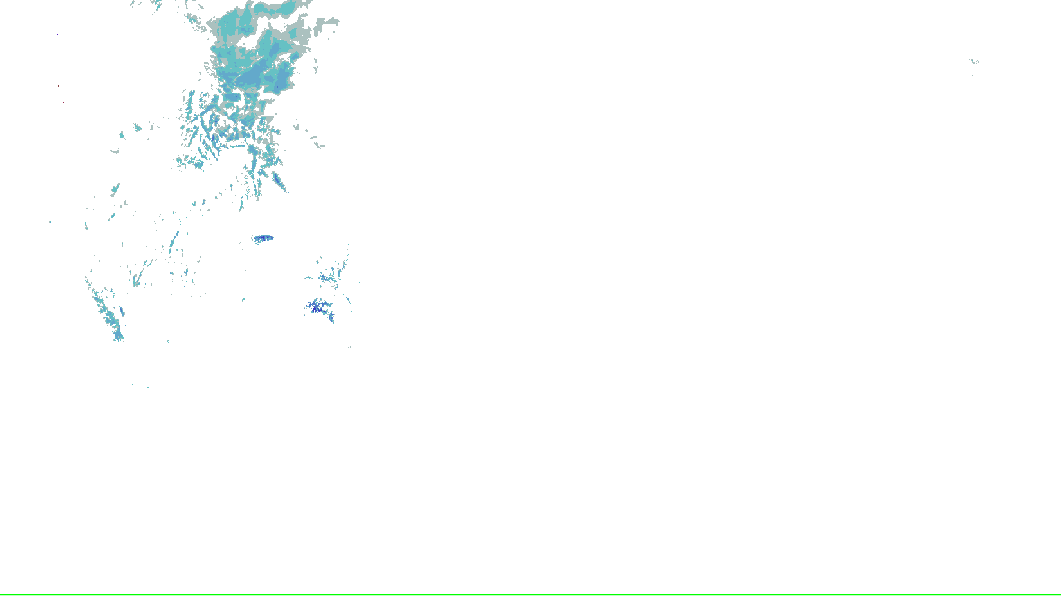
Source-rendered snow depth and snow water equivalent for the lower 48. History changes this snow picture only; warnings and radar keep their own clocks.
No NOHRSC picture displayed on the interactive map.
0 - 0.39 in
0.39 - 2.0 in
2.0 - 3.9 in
3.9 - 9.8 in
9.8 - 20 in
20 - 39 in
39 - 59 in
59 - 98 in
98 - 197 in
197 - 295 in
295 - 394 in
394 - 787 in
NOAA/NWS/NOHRSC’s original picture and legend. No station or address value is inferred.
NOHRSC footprint times are metadata; pixel analysis time is not independently verified. Snow-depth pixels have previously differed from the footprint time. This is modeled/assimilated snow analysis, not a measurement at a place. Unshaded and no-data areas do not establish zero snow.
Recorded weather · gaps are marked. Coverage begins with recording activation.
Live sources keep independent clocks.
Replay coverage and interpretation
Rolling target: 24 hours; cells: six hours. Radar: NOAA MRMS national overview, 8-minute tolerance. Satellite: original GOES GeoColor day/night picture, hourly sampling, 75-minute tolerance. No interpolation or latest-image fallback. Warning and source checks retain their own clocks. “Recorded by” is collector acquisition evidence, not exact browser publication history.
Current GLM density, velocity and specialist layers are hidden during replay. Snow uses retained footprint metadata with unverified pixel time. Forecast uses one pinned issuance/run and exact valid time.
Surface source current; observed water-level source current. Each reading keeps its own time. Map markers show at most 500 stations and 500 gauges; the complete source directory is paginated.
Circle: surface station; square: water-level gauge. Filled: current reading and source; hollow: stale, unconfirmed or missing observation. Marker color is not a hazard category. Enable “Stations and gauges” in Layers to inspect them on the map.
Continuity ended, the ID changed, or the observation left the feed. Following has stopped. Choose a current candidate in the cell list; warnings remain independent.
A new collection or source revision does not establish a consequential weather change.
Recording coverage and limits
warnings: retained from 2026-10-23T23:00:18.978Z through 2026-10-24T23:00:07.892Z
outlooks: retained from 2026-10-23T23:00:18.978Z through 2026-10-24T23:00:14.151Z
hydro: retained from 2026-10-23T23:00:18.978Z through 2026-10-24T22:55:07.016Z
analysis: retained from 2026-10-23T23:00:18.978Z through 2026-10-24T23:00:07.657Z
winter: retained from 2026-10-23T23:00:18.978Z through 2026-10-24T22:53:04.486Z
Source changes and imagery have separate recording coverage. Open Replay for retained weather frames.
Checks every minute; each layer keeps its own time.
About this monitored event
This event, as this site’s operators set it up
Kind
Severe weather
Window
Open: no start or end was set
Updated
Storm reports · preliminary
0 matching reports · 0 in this monitoring area
Source current · checked 2026-10-24T23:00:06.295Z. Convective day: 2026-10-24T12:00:00.000Z to 2026-10-25T12:00:00.000Z (12–12 UTC). Reports are filtered to the monitoring geography.
Report interpretation and source limits
All reports are preliminary. Counts are reports, not unique storms or confirmed tornadoes. Measured versus estimated values and observer identity are not separate fields in the SPC file; the original comment is preserved. Warning polygons and radar-cell detections are separate evidence.
No readable reports match this scope and type in this cached convective-day file. Missing reports do not establish safe conditions.
Spotlight: SPC Day 1 outlook
1 of 8
SPC Day 1 outlook
General Thunderstorms Risk
Marginal Risk
Slight Risk highest in this area
SPC’s Day 1 categorical outlook, valid to , issued . SPC’s categories, as drawn. Data: NOAA/SPC.
Watches
Severe Thunderstorm Watch 697until
SPC’s watches, by number, matched by the counties they list. Data: NOAA/SPC.
Mesoscale discussions
No mesoscale discussion reaches this area.
SPC’s mesoscale discussions whose outline reaches the area. Data: NOAA/SPC.
Storm ingredients
SPC’s hourly mesoanalysis, observed soundings and model guidance for the area, on the Analysis tab with its own clocks.
Severe Thunderstorm Warning issued by NWS El Paso Tx/Santa Teresa NM: El Paso and Hudspeth counties, TX
Flash Flood Warning issued by NWS El Paso Tx/Santa Teresa NM: Dona Ana County, NM; El Paso County, TX
Severe Thunderstorm Warning issued by NWS El Paso Tx/Santa Teresa NM: Dona Ana County, NM; El Paso County, TX
Severe Thunderstorm Warning issued by NWS El Paso Tx/Santa Teresa NM: El Paso County, TX
Severe Thunderstorm Warning issued by NWS El Paso Tx/Santa Teresa NM: Dona Ana County, NM; El Paso County, TX
Mesoscale Discussion 2407 no longer in force: Central and Southern New Mexico into far West Texas
The products’ own words and times, and what is no longer in force since the last read. Never written by AI.
Monitoring area details
Area
Texas (NWS states: TX)
Hazards
Tornado, severe thunderstorm, flash flood, river flood, areal flood, coastal flood and other warnings, watches and advisories, and the forecasts for them
Window
In force now, with the next days of SPC’s and WPC’s products
Made by
This site’s operators, in its admin console. Nothing about a reader is stored. Watch another area
An area the operators chose, not a storm’s footprint: everything here is in force in this area, never “from this event”.
Published alerts in this area 9
Severe Thunderstorm Warning55 new · until 23:45Z
Flash Flood Warning11 new · until 25 Oct 02:00Z
Severe Thunderstorm Watch1until 25 Oct 04:00Z
Flood Watch21 not yet in effect · until 25 Oct 12:00Z
Not an official warning service. Warnings and watches are the National Weather Service’s, outlooks and reports the Storm Prediction Center’s and the Weather Prediction Center’s (Data: NOAA/NWS, NOAA/SPC, NOAA/WPC). When a warning is issued for you, act on it, and use weather.gov or a NOAA Weather Radio for where you are.


 0 - 0.39 in
 0.39 - 2.0 in
 2.0 - 3.9 in
 3.9 - 9.8 in
 9.8 - 20 in
 20 - 39 in
 39 - 59 in
 59 - 98 in
 98 - 197 in
 197 - 295 in
 295 - 394 in
 394 - 787 in